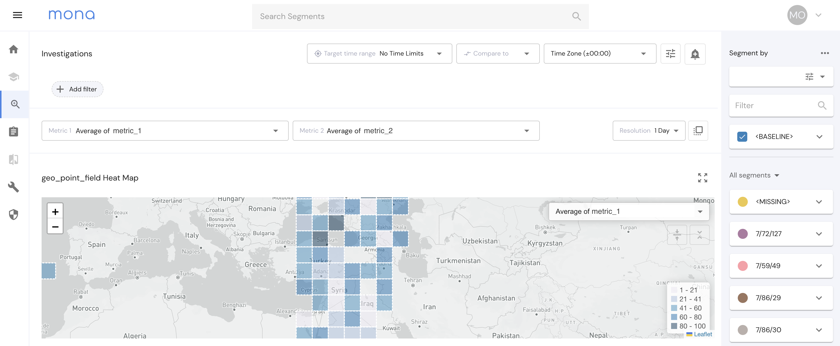
GeoPoints
In some cases, there could be specific geographical locations associated with system runs. With the Geopoint field type, users can send data of specific geographical points to Mona, segment their data on a grid according to them, view the grid on a map, and use our internal ETL functions to create more fields derived from those Geopoints.
In the near future, grid segmentation according to geo_points will also be supported in insight generation.

Geo Point formats
Mona supports 4 different formats for geo_point data:
{
  "geo_point_1": "69.16318550274269,62.75081140117096",
  "geo_point_2": "POINT (69.16318550274269 62.75081140117096)",
  "geo_point_3": {
    "lat": 69.16318550274269,
    "lon": 62.75081140117096
  },
  "geo_point_4": [
    69.16318550274269,
    62.75081140117096
  ]
}
Geo Point Field Configuration
To configure a geo_point field on Mona, use the following field configuration:
{
  "geo_point_1": {
    "type": "geo_point",
    "segmentations": {
      "original": {
        "type": "grid",
        "zoom": 7,
        "default": true
      }
    }
  }
}
For now, the only segmentation option for Geo Points is “grid”, with a zoom option from 0 to 29. Changing the zoom will affect the segmentation of a point in the data and in the investigations page map.
Updated 3 months ago
